I love going on adventures with friends/family. Its a great way to live life and test yourself and your gear.
REQUIREMENTS:
- Adventure planning
- Finding fun trails and adventures
- Route planning (before, during and after)
- Adjusting plans on the fly to find unexplored areas. To me, this is often the most fun part of adventures is just exploring. Being able to find your way out is critical!
- Sharing routes and journaling
- Time saving tools
- Non-bulky
Common tools:
- Guide to Moab, UT Backroads & 4-Wheel-Drive Trails 3rd Edition
- This is a great way to read up on trails, have a hard copy backup
- FunTreks – great way to have a pre-planned route for trail riding.
Garmin GPS. To me, these are robust, but clunky with limited maps and a pain to manage compared to a mobile device app like Gaia GPS.
Pros
- Robust
- Relatively inexpensive. I ran a garmin for a year, after finding Gaia GPS, I sold it cuz I never used it because it was such a pain to load basecamp and then sync it…ugg
- Swappable batteries.
-
Cons
- Not convenient for route planning.
- You can’t make changes on the fly
- Limited on maps
- Usually very small screen
My all time fav is the GAIA GPS.
With hundreds of overlay maps, 7 concurrent overlays maps that are easy to load and pre-download. IMO, the $40 a year is worth it for the time saving and on-the-fly maneuvering.
- Cons
- If you don’t have a way to charge your mobile device, or you break your mobile device, you might be stuck (have multiple navigators and multiple tools).
- PROS
- I love using a ram mount so I can see the map as I ride motorcycle/UTV/Truck
- You can put this on a large tablet that has a GPS for better viewing vs a tiny garmin screen.
- You can run this on your smart phone or tablet or laptop browser and they all sync effortlessly.
- Pre-download maps on wifi or cell data before you are in the wild.
- Topo, satellite, forest service, nat geo, hunting, hiking, biking…A LOT of maps.
- So many times, I’ve been on an ADV and needed to see satellite for unmarked trails to navigate out of a sticky situation.
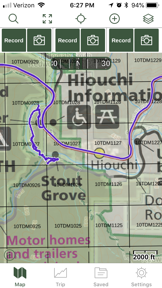
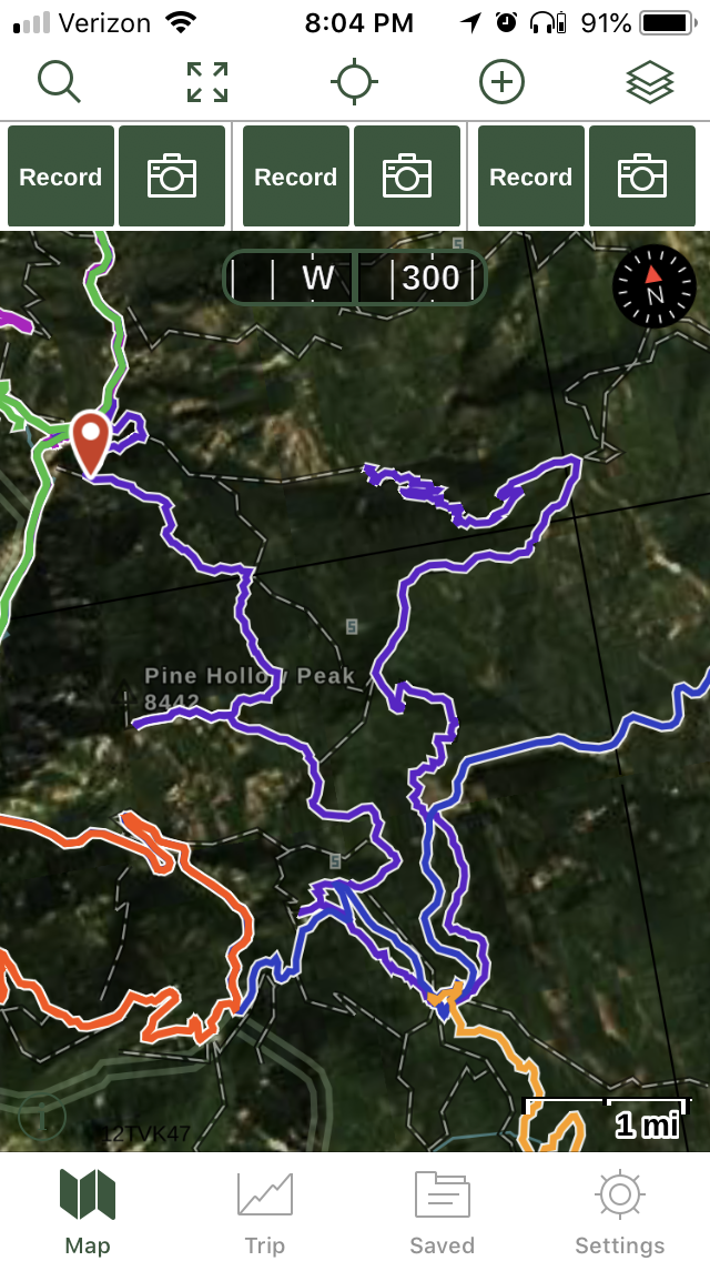
- Route/Map sharing is easy. Just hit record and it’ll track your ADV. Key for finding your way out too!
- Journaling ADV is easy. I did 7 mile rim a 2nd time, and it was nice to see where we turned off from the previous time almost a year before.
GAIA GPS RESOURCES:
Great Youtube vids to get started with GAIA
https://www.youtube.com/watch?v=dkL6MaWCAPA
https://www.youtube.com/watch?v=BkYrpriHIVU
Some screenshots of my GAIA GPS
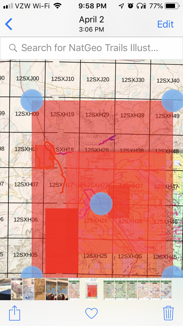
You can pre-download an area.
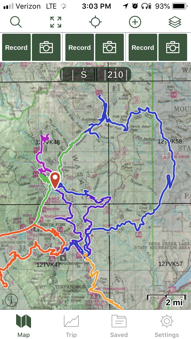
Some trails are marked very well, like American Fork Canyon:
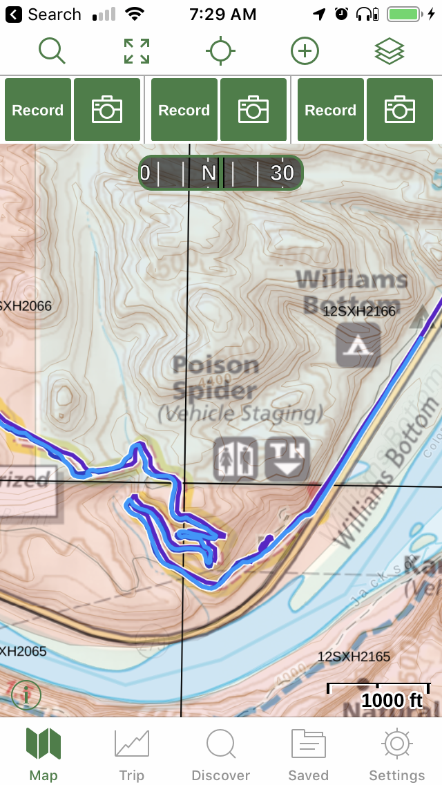
My all time fav SXS trail! Poison Spider
This shows the national parks “map” overlay, which is really nice!